
 MEET CLARA - THE AI BEHIND SMARTER SOFTWARE CHOICES


70% SW Score The SW Score ranks the products within a particular category on a variety of parameters, to provide a definite ranking system. Read more
Farmland maps and reports for Argentina and the US
This profile is currently managed by the official vendor through the SaaSworthy Vendor Portal. Product details, features, pricing, and media assets are maintained directly by the company.

 Deep Dive with Clara AI
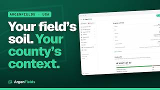
ArgenFields is a web platform for understanding farmland in Argentina and the contiguous United States. Explore mapped parcels or define a field boundary to read a technical report bringing together soil, climate, water, terrain, land use, mapped risks and routes to market. US reports combine public datasets including USDA NRCS SSURGO and NCCPI, USDA NASS, USGS and FEMA, depending on the section and location. County pages and soil-series articles provide regional context. New US features include indicative cash-rent and land-value ranges, an initial solar-potential screening and dated regional grain-price reports with basis. In Argentina, soil and terrain information draws on INTA, IGN and other public sources identified in each section. A map assistant helps users explore the available information. The map, regional pages and soil wiki are free. Full field reports have a weekly allowance on the free plan; paid plans add capacity. ArgenFields is not a real-estate agency and charges no commission on property transactions. Data is indicative, coverage varies, and missing information does not establish absence of risk. The platform does not replace an on-site study or an appraisal.
Read more


Pricing
SW Score Breakdown
Platforms Supported
Organization Types Supported
API Support
Modes of Support
Spatial Analysis
Supports manipulation of geographical data or imagery for better geovisualization in a different context, applications, and operationsInternet Mapping
Allows to store and display Internet topological data in a systematic wayMap Sharing
Allows exchanging the created maps with others for better collaborationMap Creation
Helps in creating maps using less effort and in less timeLabeling
Supports adding labels to certain items for its quick and easy identificationInteroperability
This feature enables the system to share resources with other system/software and make good use of the exchanged dataImage Management
Automates the graphical data management and monitoring tasks for easy accessibilityImage Exporting
Supports export of graphical data at different sizes and formatGeocoding
Enables users to convert an address into spatial data to find the coordinates of an address or placeColor Coding
Allows highlighting different significant information by using different colors for easy identificationCensus Data Integration
Helps to collect census data from multiple sources and display it in a unified form in a single database3D Imagery
Supports stereoscopic imaging where a technique is used to record and display images by creating an illusion of depth in themSoil & Weather Data Integration
Field Mapping & GIS Integration
Reporting & Analytics
Farm Equipment Integration
Yield Monitoring & Forecasting
IoT & Sensor Integration
Variable Rate Application (VRA)
Crop Monitoring & Analysis
Free Trial
Not available
No Credit Card Required, Get Started for Free
Free Free
The map, regional pages and soil wiki are free. Full reports have a weekly allowance on the free plan. Paid plans add capacity; see the current pricing page for details.
98% SW Score The SW Score ranks the products within a particular category on a variety of parameters, to provide a definite ranking system. Read more
97% SW Score The SW Score ranks the products within a particular category on a variety of parameters, to provide a definite ranking system. Read more

95% SW Score The SW Score ranks the products within a particular category on a variety of parameters, to provide a definite ranking system. Read more
94% SW Score The SW Score ranks the products within a particular category on a variety of parameters, to provide a definite ranking system. Read more
94% SW Score The SW Score ranks the products within a particular category on a variety of parameters, to provide a definite ranking system. Read more
91% SW Score The SW Score ranks the products within a particular category on a variety of parameters, to provide a definite ranking system. Read more
89% SW Score The SW Score ranks the products within a particular category on a variety of parameters, to provide a definite ranking system. Read more
91% SW Score The SW Score ranks the products within a particular category on a variety of parameters, to provide a definite ranking system. Read more

91% SW Score The SW Score ranks the products within a particular category on a variety of parameters, to provide a definite ranking system. Read more

ArgenFields: US f...

US field report: ...

US field report: ...

US county pages: ...
Which countries does ArgenFields cover?
What is ArgenFields used for?
ArgenFields is Geographic Information System Software. ArgenFields offers the following functionalities:
Learn more about ArgenFields features.
What are the top alternatives for ArgenFields?
Here`s a list of the best alternatives for ArgenFields:
Does ArgenFields provide API?
No, ArgenFields does not provide API.
Vendor Details
Not available
Contact Details
Not available
https://www.argenfields.com/en
Social Media Handles
SaaSworthy may receive compensation from some vendors featured on this page. This does not influence our editorial evaluation or ratings. [email protected]

Looking for the right SaaS
We can help you choose the best SaaS for your specific requirements. Our in-house experts will assist you with their hand-picked recommendations.

Want more customers?
Our experts will research about your product and list it on SaaSworthy for FREE.


