This product profile is currently unclaimed.
The listing is published on SaaSworthy, but the official vendor does not yet manage it. Are you part of the PolicyMap team? Claim this profile to manage and update your product information.
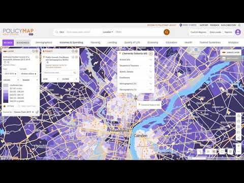
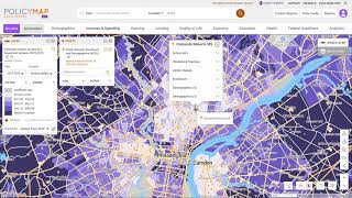
PolicyMap offers easy-to-use online mapping with data on demographics, real estate, health, jobs and more in communities across the US. From the classroom to the boardroom, thousands of organizations trust PolicyMap to find the right data for their research, market studies, business planning, site selection, grant applications and impact analysis. The most location data on the web curated, cleaned, standardized, and always updated. PolicyMap products are powered by our growing and current library of indicators, from more than 150 authoritative public and proprietary sources.
Read more
Pricing
SW Score Breakdown
Platforms Supported
Organization Types Supported
API Support
Modes of Support
Spatial Analysis
Supports manipulation of geographical data or imagery for better geovisualization in a different context, applications, and operationsMap Sharing
Allows exchanging the created maps with others for better collaborationMap Creation
Helps in creating maps using less effort and in less timeLabeling
Supports adding labels to certain items for its quick and easy identificationInternet Mapping
Allows to store and display Internet topological data in a systematic wayImage Exporting
Supports export of graphical data at different sizes and formatGeocoding
Enables users to convert an address into spatial data to find the coordinates of an address or placeCensus Data Integration
Helps to collect census data from multiple sources and display it in a unified form in a single database3D Imagery
Supports stereoscopic imaging where a technique is used to record and display images by creating an illusion of depth in themInteroperability
This feature enables the system to share resources with other system/software and make good use of the exchanged dataImage Management
Automates the graphical data management and monitoring tasks for easy accessibilityColor Coding
Allows highlighting different significant information by using different colors for easy identificationFree Trial
Not available
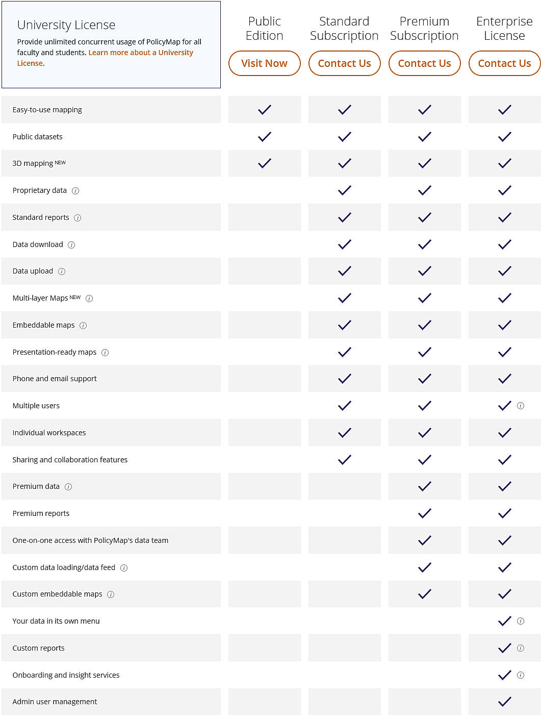
Public Edition Custom
Features
Standard Subscription Custom
Features
Premium Subscription Custom
Features
Enterprise License Custom
Features
Screenshots of Vendor Pricing Page
Disclaimer: The pricing details were last updated on 01/04/2021 from the vendor website and may be different from actual. Please confirm with the vendor website before purchasing.
Learn more about PolicyMap Pricing
78% SW Score The SW Score ranks the products within a particular category on a variety of parameters, to provide a definite ranking system. Read more
92% SW Score The SW Score ranks the products within a particular category on a variety of parameters, to provide a definite ranking system. Read more
87% SW Score The SW Score ranks the products within a particular category on a variety of parameters, to provide a definite ranking system. Read more
83% SW Score The SW Score ranks the products within a particular category on a variety of parameters, to provide a definite ranking system. Read more
83% SW Score The SW Score ranks the products within a particular category on a variety of parameters, to provide a definite ranking system. Read more
92% SW Score The SW Score ranks the products within a particular category on a variety of parameters, to provide a definite ranking system. Read more
76% SW Score The SW Score ranks the products within a particular category on a variety of parameters, to provide a definite ranking system. Read more
96% SW Score The SW Score ranks the products within a particular category on a variety of parameters, to provide a definite ranking system. Read more
73% SW Score The SW Score ranks the products within a particular category on a variety of parameters, to provide a definite ranking system. Read more
Overview of the n...
The New PolicyMap...
What is PolicyMap used for?
PolicyMap is Geographic Information System Software. PolicyMap offers the following functionalities:
Learn more about PolicyMap features.
What are the top alternatives for PolicyMap?
Here`s a list of the best alternatives for PolicyMap:
Does PolicyMap provide API?
Yes, PolicyMap provides API.
Vendor Details
Philadelphia, Pennsylvania Founded : 2007Social Media Handles
This research is curated from diverse authoritative sources; feel free to share your feedback at [email protected]
Looking for the right SaaS
We can help you choose the best SaaS for your specific requirements. Our in-house experts will assist you with their hand-picked recommendations.
Want more customers?
Our experts will research about your product and list it on SaaSworthy for FREE.
