94% SW Score The SW Score ranks the products within a particular category on a variety of parameters, to provide a definite ranking system. Read more
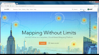
An intuitive location and intelligence tool for everyone based on mapping and analysis mechanism
This product profile is currently unclaimed.
The listing is published on SaaSworthy, but the official vendor does not yet manage it. Are you part of the ArcGIS Online team? Claim this profile to manage and update your product information.
ArcGIS Online is a Geographical Information System (GIS) mapping software for individuals and companies that enables them to connect people, locations and data using interactive maps. With this software, users get access to smart, data-driven styles and analysis tools that deliver location intelligence. It allows them to share their insights within specific groups or all over the internet. Companies can create interactive maps to explain their data and encourage customers to explore further. They can also create web apps with these maps to offer a more focused and interactive experience. Users can receive secure and straightforward access to the data, maps and apps they need to do their work. ArcGIS Online understands users' data in the context of location by using intuitive analysis tools. The software is enterprise-ready, which means it comes loaded with the security, authentication, privacy and user management needs of large organisations.
Read more


Pricing
SW Score Breakdown
Platforms Supported
Organization Types Supported
API Support
Modes of Support
Spatial Analysis
Supports manipulation of geographical data or imagery for better geovisualization in a different context, applications, and operationsMap Sharing
Allows exchanging the created maps with others for better collaborationMap Creation
Helps in creating maps using less effort and in less timeLabeling
Supports adding labels to certain items for its quick and easy identificationInternet Mapping
Allows to store and display Internet topological data in a systematic wayImage Management
Automates the graphical data management and monitoring tasks for easy accessibilityImage Exporting
Supports export of graphical data at different sizes and formatGeocoding
Enables users to convert an address into spatial data to find the coordinates of an address or placeColor Coding
Allows highlighting different significant information by using different colors for easy identificationCensus Data Integration
Helps to collect census data from multiple sources and display it in a unified form in a single database3D Imagery
Supports stereoscopic imaging where a technique is used to record and display images by creating an illusion of depth in themInteroperability
This feature enables the system to share resources with other system/software and make good use of the exchanged dataFree Trial
Available
Creator (For Team) Custom
Features
Included:
Viewer (For Team) Custom
Features:
Included
Field Worker (For Team) Custom
Features:
Included:
Editor (For Team) Custom
Features:
Included:
GIS Professional Basic Custom
Features:
Included:
GIS Professional Standard Custom
Features:
Included:
GIS Professional Advanced Custom
Features:
Included:
ArcGIS for Personal Use (Individual) $100.00 $100.00 per year
Features:
Included:
ArcGIS for Student Use(Individual) $100.00 $100.00 per year
Features:
Included:
Screenshots of Vendor Pricing Page
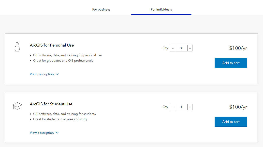
Learn more about ArcGIS Online Pricing
78% SW Score The SW Score ranks the products within a particular category on a variety of parameters, to provide a definite ranking system. Read more
90% SW Score The SW Score ranks the products within a particular category on a variety of parameters, to provide a definite ranking system. Read more
86% SW Score The SW Score ranks the products within a particular category on a variety of parameters, to provide a definite ranking system. Read more
90% SW Score The SW Score ranks the products within a particular category on a variety of parameters, to provide a definite ranking system. Read more
72% SW Score The SW Score ranks the products within a particular category on a variety of parameters, to provide a definite ranking system. Read more
78% SW Score The SW Score ranks the products within a particular category on a variety of parameters, to provide a definite ranking system. Read more
70% SW Score The SW Score ranks the products within a particular category on a variety of parameters, to provide a definite ranking system. Read more
74% SW Score The SW Score ranks the products within a particular category on a variety of parameters, to provide a definite ranking system. Read more
Introduction to A...
Performing Analys...

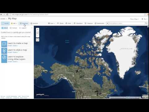
Get started ago

Group

Find Map
What is ArcGIS Online used for?
ArcGIS Online is Geographic Information System Software. ArcGIS Online offers the following functionalities:
Learn more about ArcGIS Online features.
What are the top alternatives for ArcGIS Online?
Here`s a list of the best alternatives for ArcGIS Online:
Does ArcGIS Online provide API?
Yes, ArcGIS Online provides API.
Vendor Details
Redlands, CaliforniaSocial Media Handles
This research is curated from diverse authoritative sources; feel free to share your feedback at [email protected]
Looking for the right SaaS
We can help you choose the best SaaS for your specific requirements. Our in-house experts will assist you with their hand-picked recommendations.
Want more customers?
Our experts will research about your product and list it on SaaSworthy for FREE.