This product profile is currently unclaimed.
The listing is published on SaaSworthy, but the official vendor does not yet manage it. Are you part of the GISCARTA team? Claim this profile to manage and update your product information.
The future of interactive mapping is here, and it doesn't require complex programming skills. Introducing GISCARTA— pathway to a personalized mapping vision, effortlessly brought to life sans code. Picture the application gleaming with the brand's distinctive hues, logo, and tailored text; it's not just a dream, but an easily attainable reality with GISCARTA. By harnessing the power to display vital data within a dynamic map interface, unlock a world of possibilities for users—all achieved without the painstaking task of coding. GISCARTA is more than just a mapping solution; it is an innovation hub brimming with over 20 customizable widgets from the comprehensive library. These widgets are designed to enrich user experience and enhance the functionality of the app. One can now deliver customized maps directly to stakeholders, seamlessly simplifying their interaction with data and heightening the utility of the service. Expanding the project portfolio becomes a breeze with GISCARTA. The platform is engineered to empower the existing team to do more and reach new heights in project development. Discover how GISCARTA can revolutionize the company's approach to leveraging maps, all while circumventing the necessity for coding expertise. Elevate the geodata integration and complete projects with finesse, efficiency, and a bold declaration of the brand's identity. Engage with us to extract unparalleled value from maps and propel the business ahead.
Read more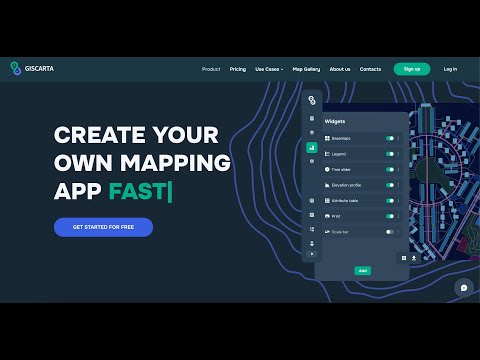
Pricing
SW Score Breakdown
Platforms Supported
Organization Types Supported
API Support
Modes of Support
Spatial Analysis
Supports manipulation of geographical data or imagery for better geovisualization in a different context, applications, and operationsMap Sharing
Allows exchanging the created maps with others for better collaborationMap Creation
Helps in creating maps using less effort and in less timeLabeling
Supports adding labels to certain items for its quick and easy identificationInteroperability
This feature enables the system to share resources with other system/software and make good use of the exchanged dataImage Management
Automates the graphical data management and monitoring tasks for easy accessibilityGeocoding
Enables users to convert an address into spatial data to find the coordinates of an address or placeColor Coding
Allows highlighting different significant information by using different colors for easy identificationInternet Mapping
Allows to store and display Internet topological data in a systematic wayImage Exporting
Supports export of graphical data at different sizes and formatCensus Data Integration
Helps to collect census data from multiple sources and display it in a unified form in a single database3D Imagery
Supports stereoscopic imaging where a technique is used to record and display images by creating an illusion of depth in themFree Trial
Not available
Free Free
Features
Standard $20.00 $29.00 per user / month
Features
Pro $80.00 $99.00 per user / month
Features
Custom Custom
Features
Screenshots of Vendor Pricing Page
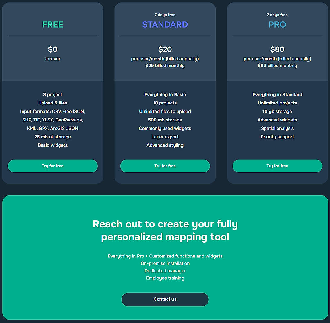
Disclaimer: The pricing details were last updated on 04/04/2024 from the vendor website and may be different from actual. Please confirm with the vendor website before purchasing.
Learn more about GISCARTA Pricing
92% SW Score The SW Score ranks the products within a particular category on a variety of parameters, to provide a definite ranking system. Read more
96% SW Score The SW Score ranks the products within a particular category on a variety of parameters, to provide a definite ranking system. Read more
78% SW Score The SW Score ranks the products within a particular category on a variety of parameters, to provide a definite ranking system. Read more
92% SW Score The SW Score ranks the products within a particular category on a variety of parameters, to provide a definite ranking system. Read more
76% SW Score The SW Score ranks the products within a particular category on a variety of parameters, to provide a definite ranking system. Read more
82% SW Score The SW Score ranks the products within a particular category on a variety of parameters, to provide a definite ranking system. Read more
98% SW Score The SW Score ranks the products within a particular category on a variety of parameters, to provide a definite ranking system. Read more
87% SW Score The SW Score ranks the products within a particular category on a variety of parameters, to provide a definite ranking system. Read more

Introduction to G...
What is GISCARTA used for?
GISCARTA is Geographic Information System Software. GISCARTA offers the following functionalities:
Learn more about GISCARTA features.
What are the top alternatives for GISCARTA?
Here`s a list of the best alternatives for GISCARTA:
Does GISCARTA provide API?
No, GISCARTA does not provide API.
Vendor Details
Mountain View, CaliforniaSocial Media Handles
This research is curated from diverse authoritative sources; feel free to share your feedback at [email protected]
Looking for the right SaaS
We can help you choose the best SaaS for your specific requirements. Our in-house experts will assist you with their hand-picked recommendations.
Want more customers?
Our experts will research about your product and list it on SaaSworthy for FREE.
