Mapbox |
79% SW Score The SW Score ranks the products within a particular category on a variety of parameters, to provide a definite ranking system. Read more
Visit Website
|
75% SW Score The SW Score ranks the products within a particular category on a variety of parameters, to provide a definite ranking system. Read more
Visit Website
|
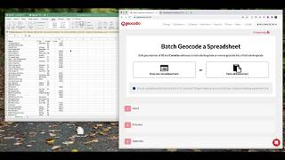
| Description | Mapme is a no-code interactive mapping platform that allows organizations to transform location-based data into structured, visual experiences. It enables teams to create custom maps featuring places, points of interest, programs, or geographic datasets without technical or GIS expertise. Users can add locations manually or import data from spreadsheets such as CSV or Google Sheets. Each location can include descriptions, images, links, categories, and tags, making it easy for viewers to search, filter, and explore information. Maps can be styled to match branding guidelines and embedded into websites, landing pages, or internal portals. The platform supports centralized content management, collaborative editing, and ongoing updates, making it suitable for teams that manage evolving geographic information. Mapme is used across industries including travel and tourism, education, economic development, real estate, and community initiatives. It is particularly useful for organizations that need to present complex location data in a clear, interactive, and accessible format. Read more | Geocodio has easy-to-use tools like spreadsheet upload and an API, friendly restriction-free terms of use, affordable pay-as-you-go pricing with a generous free tier, and a truly unlimited option for high-volume needs. Save time by appending other data points you need, like Congressional districts and timezones. Read more |
| Pricing Options |
|
|
| SW Score & Breakdown |
79% SW Score The SW Score ranks the products within a particular category on a variety of parameters, to provide a definite ranking system. Read more
|
75% SW Score The SW Score ranks the products within a particular category on a variety of parameters, to provide a definite ranking system. Read more
|
| Total Features |
5 Features
|
3 Features
|
| Common Features for All |
3D Imagery
Census Data Integration
Color Coding
Image Exporting
Map Creation
Map Sharing
|
3D Imagery
Census Data Integration
Color Coding
Image Exporting
Map Creation
Map Sharing
|
| Organization Types Supported |
|
|
| Platforms Supported |
|
|
| Modes of Support |
|
|
| API Support |
|
|
| User Rating |
|
|
| Rating Distribution |
|
|
| Read All User Reviews | Read All User Reviews |
AI-Generated from the text of User Reviews
| Pricing Options |
|
|
|
Pricing Plans
Monthly Plans
Annual Plans
|
Starter $30.00 $50.00 per month Professional $55.00 $90.00 per month Expert $110.00 $180.00 per month Enterprise Custom |
Pay as You Go Custom Unlimited Geocoding $1,000.00 $1,000.00 per month |
|
View Detailed Pricing
|
View Detailed Pricing
|
Get personalized recommendations from our experts on call
Trusted by more than 5 Million users across the globe.
Thank you for the enquiry. One of our software analysts will contact you soon.
| Screenshots |

|

|
| Videos |

|
+ 2 More
|
| Company Details |
Not available |
Located in: Arlington, Virginia Founded in: 2014 |
| Contact Details |
Not available |
Not available |
| Social Media Handles |
|
|
Looking for the right SaaS
We can help you choose the best SaaS for your specific requirements. Our in-house experts will assist you with their hand-picked recommendations.
Want more customers?
Our experts will research about your product and list it on SaaSworthy for FREE.


