83% SW Score The SW Score ranks the products within a particular category on a variety of parameters, to provide a definite ranking system. Read more
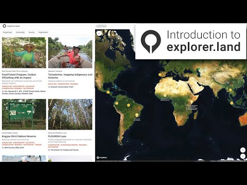
Web maps for forest and conservation projects
This product profile is currently unclaimed.
The listing is published on SaaSworthy, but the official vendor does not yet manage it. Are you part of the explorer.land team? Claim this profile to manage and update your product information.
explorer.land is the presentation platform for sustainable forest and landscape projects. Based on web-maps and geo-content, it allows projects to tell their story in a transparent way.
Read more


Pricing
SW Score Breakdown
Platforms Supported
Organization Types Supported
API Support
Modes of Support
Spatial Analysis
Supports manipulation of geographical data or imagery for better geovisualization in a different context, applications, and operationsMap Sharing
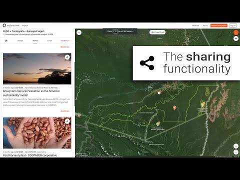
Allows exchanging the created maps with others for better collaborationMap Creation
Helps in creating maps using less effort and in less timeLabeling
Supports adding labels to certain items for its quick and easy identificationInternet Mapping
Allows to store and display Internet topological data in a systematic wayImage Exporting
Supports export of graphical data at different sizes and formatGeocoding
Enables users to convert an address into spatial data to find the coordinates of an address or placeInteroperability
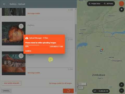
This feature enables the system to share resources with other system/software and make good use of the exchanged dataImage Management
Automates the graphical data management and monitoring tasks for easy accessibilityColor Coding
Allows highlighting different significant information by using different colors for easy identificationCensus Data Integration
Helps to collect census data from multiple sources and display it in a unified form in a single database3D Imagery
Supports stereoscopic imaging where a technique is used to record and display images by creating an illusion of depth in themFree Trial
Not available
Free Free
Create, publish, and embed beautiful project web maps and share them with your supporters and during presentations.
Features
Starter Custom
Build out impressive map-based project presentations. Onboard your team and show your project story in detail and transparently.
Features
Standard Custom
Power-users, and growing teams that need unlimited space for story posts and geolocations. Training and data import included.
Features
Premium Custom
Professional project communication that needs structured reporting and storytelling for larger initiatives or corporate sponsors.
Features
Screenshots of Vendor Pricing Page

Learn more about explorer.land Pricing
74% SW Score The SW Score ranks the products within a particular category on a variety of parameters, to provide a definite ranking system. Read more
83% SW Score The SW Score ranks the products within a particular category on a variety of parameters, to provide a definite ranking system. Read more
78% SW Score The SW Score ranks the products within a particular category on a variety of parameters, to provide a definite ranking system. Read more
87% SW Score The SW Score ranks the products within a particular category on a variety of parameters, to provide a definite ranking system. Read more
80% SW Score The SW Score ranks the products within a particular category on a variety of parameters, to provide a definite ranking system. Read more
90% SW Score The SW Score ranks the products within a particular category on a variety of parameters, to provide a definite ranking system. Read more
85% SW Score The SW Score ranks the products within a particular category on a variety of parameters, to provide a definite ranking system. Read more
86% SW Score The SW Score ranks the products within a particular category on a variety of parameters, to provide a definite ranking system. Read more
78% SW Score The SW Score ranks the products within a particular category on a variety of parameters, to provide a definite ranking system. Read more
Introduction to O...
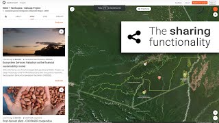
Feature: The Shar...
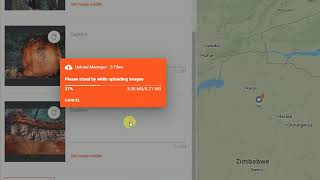
Feature: Upload M...

Project Map

Base Map

Geo Localized Con...

Geo Reporting
Vendor Details
Krefeld, GermanySocial Media Handles


This research is curated from diverse authoritative sources; feel free to share your feedback at [email protected]
Looking for the right SaaS
We can help you choose the best SaaS for your specific requirements. Our in-house experts will assist you with their hand-picked recommendations.
Want more customers?
Our experts will research about your product and list it on SaaSworthy for FREE.


