Mapbox |
86% SW Score The SW Score ranks the products within a particular category on a variety of parameters, to provide a definite ranking system. Read more
Visit Website
|
76% SW Score The SW Score ranks the products within a particular category on a variety of parameters, to provide a definite ranking system. Read more
Visit Website
|
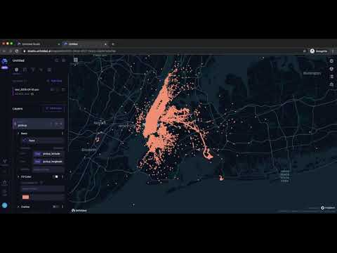
| Description | QGIS is a professional geographic information system application explicitly designed by a team of dedicated organizations and volunteers for GIS monitoring. It is built with all and highly appreciative independent tools and it is a complete open-source software. It is a user-friendly, open-source geographic system authorized under the general public license (GNU). This software community strives to be a welcoming team for people of all castes, races, gender, and status. Moreover, the QGIS project offers a user guide, GIS introduction, compilation, and coding guide with API documentation in English. In some other cases, it is also translated into various foreign languages. QGIS is an approved project of the OSGeo (open-source geospatial foundation). It operates on Mac OSX, Linux, Unix, Android, Windows and supports several vectors, bitmap, and database functionalities and formats. QGIS is a reliable and robust software and comprises all the features that one needs to pay for in other GIS applications. It is proficiently cost-effective with free version attributes, user-friendly with advanced features making it an ideal choice over other paid softwares available. Read more | Unfolded Studio is a unique platform that makes operations with geospatial data science easy. With this software’s integrated layer catalogue and advanced timeline animation capabilities, geospatial data can be converted into insightful maps. Different data formats including ShapeFiles, VectorTiles and Cloud-Optimised GeoTIFFs can be easily combined together, besides collaborating with conventional data formats like CSV and GeoJSON. Unfolded Studio focuses on large data analytics, Spatio-temporal unification and unparalleled performance in-browser data visualisation. Further, it is a highly integrated SaaS tool that extends several of its contemporaries thanks to features like secure storage, advanced analytics backend, geospatial unification, data catalogue, developer SDKs among others. Geo Analytics enables thorough analysis of uploaded data by grouping rows and joining tables. Custom metrics allow cross-filtration of data and correlating the existing columns. Insights can thus be arrived at within minutes thanks to the software’s intuitive analytic capabilities that also provide visual and informative feedback. Creating and sharing stories through Unfolded Studio is simple with its user-friendly interface and well-explained functions. Read more |
| Pricing Options |
|
|
| SW Score & Breakdown |
86% SW Score The SW Score ranks the products within a particular category on a variety of parameters, to provide a definite ranking system. Read more
|
76% SW Score The SW Score ranks the products within a particular category on a variety of parameters, to provide a definite ranking system. Read more
|
| Total Features |
7 Features
|
6 Features
|
| Common Features for All |
3D Imagery
Color Coding
Geocoding
Image Exporting
Image Management
Interoperability
Labeling
Map Creation
Map Sharing
Spatial Analysis
|
3D Imagery
Color Coding
Geocoding
Image Exporting
Image Management
Interoperability
Labeling
Map Creation
Map Sharing
Spatial Analysis
|
| Organization Types Supported |
|
|
| Platforms Supported |
|
|
| Modes of Support |
|
|
| API Support |
|
|
| User Rating |
|
Not Available
|
| Ratings Distribution |
|
Not Available
|
| Review Summary |
Review Summary: QGIS is a highly regarded open-source GIS software praised for its extensive capabilities, user-friendly interface, and strong community support. Reviewers appreciate its wide range of features, customization options, and compatibility with various data formats. Its intuitive interface makes it accessible to users of all skill levels. QGIS is particularly valued for its spatial analysis and data management capabilities. However, some users note that the software can be complex to master and may require a learning curve. Overall, QGIS is a powerful and versatile GIS tool suitable for various applications, from basic mapping to advanced geospatial analysis. |
Not Available
|
| Read All User Reviews | Read All User Reviews |
AI-Generated from the text of User Reviews
| Pricing Options |
|
|
|
Pricing Plans
Monthly Plans
Annual Plans
|
Community Free Enterprise Custom |
|
| Not Available |
View Detailed Pricing
|
|
|
|
|
| Screenshots |

+ 5 More
|

+ 2 More
|
| Videos | Not Available |
|
| Company Details |
Not available |
Located in: 347-972-8881 |
| Contact Details |
Not available https://qgis.org/ |
Not available https://www.unfolded.ai/studio |
| Social Media Handles |
|
|
Looking for the right SaaS
We can help you choose the best SaaS for your specific requirements. Our in-house experts will assist you with their hand-picked recommendations.
Want more customers?
Our experts will research about your product and list it on SaaSworthy for FREE.


