LandScape GIS |
92% SW Score The SW Score ranks the products within a particular category on a variety of parameters, to provide a definite ranking system. Read more
Visit Website
|
86% SW Score The SW Score ranks the products within a particular category on a variety of parameters, to provide a definite ranking system. Read more
Visit Website
|
| Description | ArcGIS Online is a Geographical Information System (GIS) mapping software for individuals and companies that enables them to connect people, locations and data using interactive maps. With this software, users get access to smart, data-driven styles and analysis tools that deliver location intelligence. It allows them to share their insights within specific groups or all over the internet. Companies can create interactive maps to explain their data and encourage customers to explore further. They can also create web apps with these maps to offer a more focused and interactive experience. Users can receive secure and straightforward access to the data, maps and apps they need to do their work. ArcGIS Online understands users' data in the context of location by using intuitive analysis tools. The software is enterprise-ready, which means it comes loaded with the security, authentication, privacy and user management needs of large organisations. Read more | QGIS is a professional geographic information system application explicitly designed by a team of dedicated organizations and volunteers for GIS monitoring. It is built with all and highly appreciative independent tools and it is a complete open-source software. It is a user-friendly, open-source geographic system authorized under the general public license (GNU). This software community strives to be a welcoming team for people of all castes, races, gender, and status. Moreover, the QGIS project offers a user guide, GIS introduction, compilation, and coding guide with API documentation in English. In some other cases, it is also translated into various foreign languages. QGIS is an approved project of the OSGeo (open-source geospatial foundation). It operates on Mac OSX, Linux, Unix, Android, Windows and supports several vectors, bitmap, and database functionalities and formats. QGIS is a reliable and robust software and comprises all the features that one needs to pay for in other GIS applications. It is proficiently cost-effective with free version attributes, user-friendly with advanced features making it an ideal choice over other paid softwares available. Read more |
| Pricing Options |
|
|
| SW Score & Breakdown |
92% SW Score The SW Score ranks the products within a particular category on a variety of parameters, to provide a definite ranking system. Read more
|
86% SW Score The SW Score ranks the products within a particular category on a variety of parameters, to provide a definite ranking system. Read more
|
| Total Features |
11 Features
|
7 Features
|
| Common Features for All |
3D Imagery
Census Data Integration
Color Coding
Geocoding
Image Exporting
Image Management
Internet Mapping
Interoperability
Labeling
Map Creation
Map Sharing
Spatial Analysis
|
3D Imagery
Census Data Integration
Color Coding
Geocoding
Image Exporting
Image Management
Internet Mapping
Interoperability
Labeling
Map Creation
Map Sharing
Spatial Analysis
|
| Organization Types Supported |
|
|
| Platforms Supported |
|
|
| Modes of Support |
|
|
| API Support |
|
|
| User Rating |
|
|
| Ratings Distribution |
|
|
| Review Summary |
Overall, the feedback gathered from users indicates that the product possesses strengths in its accuracy, depth of features, and versatility. Additionally, its mapping capabilities are widely praised for their precision and detail. However, some users have expressed concerns regarding the complexity of the software and the need for extensive training to utilize it effectively. Additionally, the cost is mentioned as a potential drawback for some users. |
Review Summary: QGIS is a highly regarded open-source GIS software praised for its extensive capabilities, user-friendly interface, and strong community support. Reviewers appreciate its wide range of features, customization options, and compatibility with various data formats. Its intuitive interface makes it accessible to users of all skill levels. QGIS is particularly valued for its spatial analysis and data management capabilities. However, some users note that the software can be complex to master and may require a learning curve. Overall, QGIS is a powerful and versatile GIS tool suitable for various applications, from basic mapping to advanced geospatial analysis. |
| Pros & Cons |
|
|
| Read All User Reviews | Read All User Reviews |
AI-Generated from the text of User Reviews
| Pricing Options |
|
|
|
Pricing Plans
Monthly Plans
Annual Plans
|
Creator (For Team) Custom Viewer (For Team) Custom Field Worker (For Team) Custom Editor (For Team) Custom GIS Professional Basic Custom GIS Professional Standard Custom GIS Professional Advanced Custom ArcGIS for Personal Use (Individual) $100.00 $100.00 per year ArcGIS for Student Use(Individual) $100.00 $100.00 per year |
|
|
View Detailed Pricing
|
Not Available |
|
|
|
|
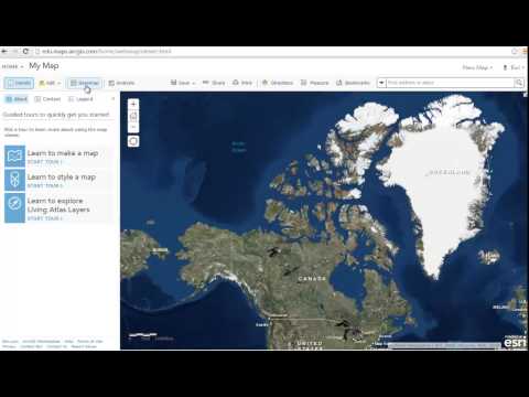
| Screenshots |

+ 2 More
|

+ 5 More
|
| Videos |
+ 1 More
|
Not Available |
| Company Details | Located in: Redlands, California |
Not available |
| Contact Details |
Not available https://www.esri.com/en-us/arcgis/products/arcgis-online/overview |
Not available https://qgis.org/ |
| Social Media Handles |
|
|
What are the key differences between ArcGIS Online and QGIS?
What are the alternatives to ArcGIS Online?
Which product is better for large-scale GIS projects?
How do the data analysis capabilities of these products differ?
Can I integrate ArcGIS Online with other SaaS products?
Looking for the right SaaS
We can help you choose the best SaaS for your specific requirements. Our in-house experts will assist you with their hand-picked recommendations.
Want more customers?
Our experts will research about your product and list it on SaaSworthy for FREE.


