Mapbox |
82% SW Score The SW Score ranks the products within a particular category on a variety of parameters, to provide a definite ranking system. Read more
Visit Website
|
75% SW Score The SW Score ranks the products within a particular category on a variety of parameters, to provide a definite ranking system. Read more
Visit Website
|
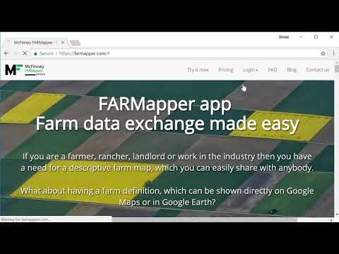
| Description | Farmapper is a mapping app for the farming industry that has been built for farmers, ranchers, landlords, and other notable stakeholders in agriculture. It makes it easy for them to build a farm data exchange system with a descriptive farm map. The farm can be directly depicted on global platforms such as Google Maps and Google Earth. Users can draw the map and built it with the help of preloaded legal description shapes while adding customizing it through stickers, colors, and more. They can also add range allotments and import polygon shapes. By creating and sharing listings for multiple categories like sales, equipment, and rent. Users can add information to their lands like deeds, legal descriptions, photos, and any other file that they want. And with a dedicated community around the product, they can also share the project with other users with specific restrictions such as read-only. Read more | With ArcGIS Schematics you can model, design, and view any kind of network, from social and economic networks to electric power, traffic light, rail, and more. It provides key features like diagrams automatically, schematic views, graphic representations and much more. Read more |
| Pricing Options |
|
|
| SW Score & Breakdown |
82% SW Score The SW Score ranks the products within a particular category on a variety of parameters, to provide a definite ranking system. Read more
|
75% SW Score The SW Score ranks the products within a particular category on a variety of parameters, to provide a definite ranking system. Read more
|
| Total Features |
11 Features
|
5 Features
|
| Common Features for All |
Census Data Integration
Color Coding
Geocoding
Image Exporting
Image Management
Internet Mapping
Interoperability
Labeling
Map Creation
Map Sharing
Spatial Analysis
|
Census Data Integration
Color Coding
Geocoding
Image Exporting
Image Management
Internet Mapping
Interoperability
Labeling
Map Creation
Map Sharing
Spatial Analysis
|
| Organization Types Supported |
|
|
| Platforms Supported |
|
|
| Modes of Support |
|
|
| Read All User Reviews | Read All User Reviews |
AI-Generated from the text of User Reviews
| Pricing Options |
|
|
|
Pricing Plans
Monthly Plans
Annual Plans
|
Pioneer Free Homesteader $10.00 $10.00 per month Land Baron $20.00 $20.00 per month Unlimited $50.00 $50.00 per month |
ArcGIS Schematics Custom |
|
View Detailed Pricing
|
View Detailed Pricing
|
|
Mergdata
4 Based on 1 Ratings |
ArcGIS 3D Analyst
4.4 Based on 29 Ratings |
|
| Screenshots |

+ 5 More
|
Not Available |
| Videos |
+ 2 More
|
Not Available |
| Company Details | Located in: Boise, ID - 83702 | Located in: Redlands, California Founded in: 1969 |
| Contact Details |
Not available https://www.farmapper.com/ |
1-800-447-9778 https://www.esri.com/en-us/arcgis/products/arcgis-schematics/overview |
| Social Media Handles |
|
Not available |
Looking for the right SaaS
We can help you choose the best SaaS for your specific requirements. Our in-house experts will assist you with their hand-picked recommendations.
Want more customers?
Our experts will research about your product and list it on SaaSworthy for FREE.


