T Sheets |
75% SW Score The SW Score ranks the products within a particular category on a variety of parameters, to provide a definite ranking system. Read more
Visit Website
|
80% SW Score The SW Score ranks the products within a particular category on a variety of parameters, to provide a definite ranking system. Read more
Visit Website
|
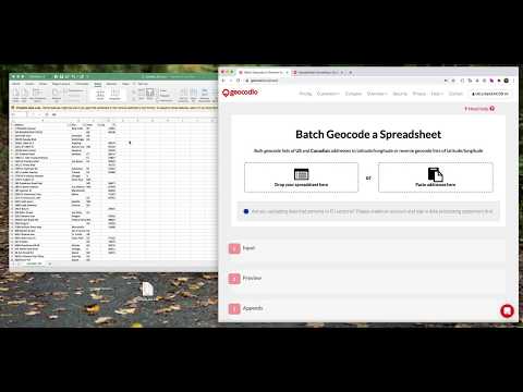
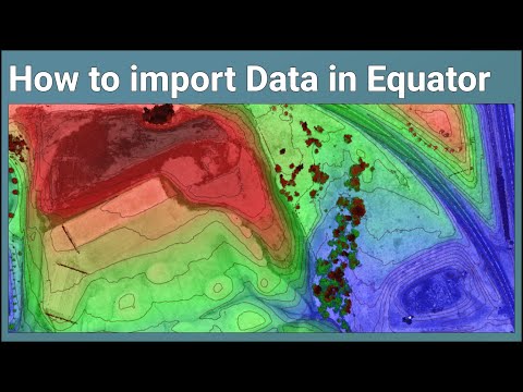
| Description | Geocodio has easy-to-use tools like spreadsheet upload and an API, friendly restriction-free terms of use, affordable pay-as-you-go pricing with a generous free tier, and a truly unlimited option for high-volume needs. Save time by appending other data points you need, like Congressional districts and timezones. Read more | Equator is online mapping software that allows anyone to find, create and publish maps in minutes. One globe, unlimited maps. Equator is mapping and design software with thousands of built-in data sets. Equator is used by civil engineers, architects, and construction professionals around the world to find, build, and share maps and designs instantly. Read more |
| Pricing Options |
|
|
| SW Score & Breakdown |
75% SW Score The SW Score ranks the products within a particular category on a variety of parameters, to provide a definite ranking system. Read more
|
80% SW Score The SW Score ranks the products within a particular category on a variety of parameters, to provide a definite ranking system. Read more
|
| Total Features |
3 Features
|
6 Features
|
| Common Features for All |
3D Imagery
Census Data Integration
Color Coding
Image Exporting
Labeling
Map Creation
Map Sharing
|
3D Imagery
Census Data Integration
Color Coding
Image Exporting
Labeling
Map Creation
Map Sharing
|
| Organization Types Supported |
|
|
| Platforms Supported |
|
|
| Modes of Support |
|
|
| API Support |
|
|
| User Rating |
|
Not Available
|
| Rating Distribution |
|
Not Available
|
| Read All User Reviews | Read All User Reviews |
AI-Generated from the text of User Reviews
| Pricing Options |
|
|
|
Pricing Plans
Monthly Plans
Annual Plans
|
Pay as You Go Custom Unlimited Geocoding $1,000.00 $1,000.00 per month |
Community Free Professional $30.00 $30.00 per user / month Enterprise Custom |
|
View Detailed Pricing
|
View Detailed Pricing
|
|
|
|
|
| Screenshots |

|
Not Available |
| Videos |
+ 2 More
|
+ 2 More
|
| Company Details | Located in: Arlington, Virginia Founded in: 2014 | Located in: Waterloo, Canada |
| Contact Details |
Not available https://www.geocod.io/ |
Not available https://equatorstudios.com/ |
| Social Media Handles |
|
|
Looking for the right SaaS
We can help you choose the best SaaS for your specific requirements. Our in-house experts will assist you with their hand-picked recommendations.
Want more customers?
Our experts will research about your product and list it on SaaSworthy for FREE.

