Mapbox |
92% SW Score The SW Score ranks the products within a particular category on a variety of parameters, to provide a definite ranking system. Read more
Visit Website
|
79% SW Score The SW Score ranks the products within a particular category on a variety of parameters, to provide a definite ranking system. Read more
Visit Website
|
| Description | ArcGIS Online is a Geographical Information System (GIS) mapping software for individuals and companies that enables them to connect people, locations and data using interactive maps. With this software, users get access to smart, data-driven styles and analysis tools that deliver location intelligence. It allows them to share their insights within specific groups or all over the internet. Companies can create interactive maps to explain their data and encourage customers to explore further. They can also create web apps with these maps to offer a more focused and interactive experience. Users can receive secure and straightforward access to the data, maps and apps they need to do their work. ArcGIS Online understands users' data in the context of location by using intuitive analysis tools. The software is enterprise-ready, which means it comes loaded with the security, authentication, privacy and user management needs of large organisations. Read more | LocationIQ delivers flexible enterprise-grade location-based solutions. Every request to the tool’s APIs or Map is required to be authenticated with a token. For user-facing applications like Javascript websites or mobile apps, users can generate new access tokens directly on the User Dashboard. Access tokens can be used in both public (websites, apps) and private (server backends) environments. Locationiq’s Search API enables converting addresses, such as a street address into geographic coordinates with latitude and longitude. These coordinates serve multiple use-cases, from placing markers on a map to aiding algorithms to determine bus stops nearby. With advanced features such as Reverse geocoding, the tool converts coordinates (latitude, longitude) to a readable address or place name. LocationIQ even includes worldwide coverage from New York to Tokyo powered by data from OpenStreetMap, Open Addresses and other sources. Its fair pricing structure with no complex agreements and no long-term commitments or hidden charges brand it as a reliable niche tool. Read more |
| Pricing Options |
|
|
| SW Score & Breakdown |
92% SW Score The SW Score ranks the products within a particular category on a variety of parameters, to provide a definite ranking system. Read more
|
79% SW Score The SW Score ranks the products within a particular category on a variety of parameters, to provide a definite ranking system. Read more
|
| Total Features |
11 Features
|
3 Features
|
| Common Features for All |
3D Imagery
Census Data Integration
Color Coding
Geocoding
Image Exporting
Image Management
Internet Mapping
Labeling
Map Creation
Map Sharing
Spatial Analysis
|
3D Imagery
Census Data Integration
Color Coding
Geocoding
Image Exporting
Image Management
Internet Mapping
Labeling
Map Creation
Map Sharing
Spatial Analysis
|
| Organization Types Supported |
|
|
| Platforms Supported |
|
|
| Modes of Support |
|
|
| API Support |
|
|
| User Rating |
|
|
| Ratings Distribution |
|
|
| Review Summary |
Overall, the feedback gathered from users indicates that the product possesses strengths in its accuracy, depth of features, and versatility. Additionally, its mapping capabilities are widely praised for their precision and detail. However, some users have expressed concerns regarding the complexity of the software and the need for extensive training to utilize it effectively. Additionally, the cost is mentioned as a potential drawback for some users. |
Not Available
|
| Read All User Reviews | Read All User Reviews |
AI-Generated from the text of User Reviews
| Pricing Options |
|
|
|
Pricing Plans
Monthly Plans
Annual Plans
|
Creator (For Team) Custom Viewer (For Team) Custom Field Worker (For Team) Custom Editor (For Team) Custom GIS Professional Basic Custom GIS Professional Standard Custom GIS Professional Advanced Custom ArcGIS for Personal Use (Individual) $100.00 $100.00 per year ArcGIS for Student Use(Individual) $100.00 $100.00 per year |
Free Free Developer $50.00 $50.00 per month Starter $100.00 $100.00 per month Business $200.00 $200.00 per month Large $600.00 $600.00 per month |
|
View Detailed Pricing
|
View Detailed Pricing
|
|
|
|
|
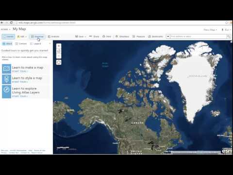
| Screenshots |

+ 2 More
|
Not Available |
| Videos |
+ 1 More
|
Not Available |
| Company Details | Located in: Redlands, California | Located in: Hyderabad, Telangana - 500033 |
| Contact Details |
Not available https://www.esri.com/en-us/arcgis/products/arcgis-online/overview |
+1-415-651-7129 https://locationiq.com/ |
| Social Media Handles |
|
|
Looking for the right SaaS
We can help you choose the best SaaS for your specific requirements. Our in-house experts will assist you with their hand-picked recommendations.
Want more customers?
Our experts will research about your product and list it on SaaSworthy for FREE.


